Bates Bridge (Hwy 601)

    Prev
  • Bates Bridge (Ron Ahle)
    Bates Bridge (Ron Ahle)
  • Bates Bridge Landing (GoogleEarth)
    Bates Bridge Landing
    (GoogleEarth)
  • Bates Bridge Landing Altered (GoogleEarth)
    Bates Bridge Landing Altered
    (GoogleEarth)
  • Next

About

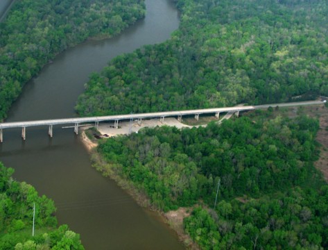
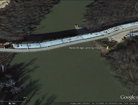
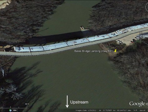
Under the John M. Bates Bridge where US 601 (McCords Ferry Road) crosses between Richland and Calhoun counties. A new bridge was under construction here in 2013.

Info

River:
Type: Access Point
Amenities: Accessible, Boat Landing, Dogs Allowed, Fishing, Kayaking, Parking
Address:
US-601 Eastover, SC

Alerts/Notes

Note: The Congaree River Blue Trail ends at Bates Bridge Landing at Highway 601 (river mile 51). The next take out is Low Falls Landing, approximately 15 miles downstream in the headwaters of Lake Marion. Bates Bridge Landing floods periodically, making it a poor choice for long-term parking.
Bates Bridge (Hwy 601) 33.75333 -80.64472