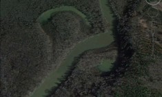
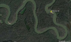
Congaree River Map
5422
5420
5418
5416
5414
5412
5409
5405
5402
5400
5398
1986
 1991
1991
 2373
2373
 2374
2374
 2375
2375
 2376
2377
2376
2377
 1964
1964
 1966
1966
 1967
1967
 1968
1968
 1970
1970
 1972
1972
 1974
1974
 1975
1975
 1976
1976
 1977
1977
 1979
2357
1979
2357
 2358
2358
 2362
2362
 2364
2366
2368
2364
2366
2368
 2369
2371
1944
2369
2371
1944
 1945
1945
 1946
1946
 1948
1948
 1949
1949
 1950
1950
 1951
1951
 1952
1954
1952
1954
 1956
1957
1959
1956
1957
1959
 1960
1960
 1961
1961
 2350
2350
 2353
2353
 2354
2355
2354
2355
 2356
2356
 1924
1924
 1925
1925
 1927
1927
 1929
1929
 1930
1930
 1931
1931
 1933
1933
 1934
1934
 1935
1935
 1936
1937
1936
1937
 1939
1939
 1941
1941
 2338
2338
 2339
2339
 2342
2342
 2343
2343
 2347
2347
 2348
2348
 2349
2349

The Vista
Gervais Street between Huger and Assembly Street. Many restaurants and businesses...
Address:
Gervais Street between Huger and Assembly Street
Gervais Street between Huger and Assembly Street
State Street
Street off of Meeting Street in West Columbia with restaurants and shops...
Address:
State Street off Meeting Street
State Street off Meeting Street
Palmetto Outdoor Center
Outfitter in West Columbia...
Address:
731 Meeting Street West Columbia, SC 29169
731 Meeting Street West Columbia, SC 29169
University of South Carolina
Flagship University of the state of South Carolina. Many historical buildings and areas such as...
Address:
910 Sumter Street Columbia, SC 29201
910 Sumter Street Columbia, SC 29201
South Carolina State Capitol
Home to South Carolina state government. The grounds are home to many monuments and memorials....
Address:
1100 Gervais Street Columbia,SC 29201
1100 Gervais Street Columbia,SC 29201
Three Rivers Greenway: Broad River Access
Dirt road off of River Drive with access to the top of the Three Rivers...
Address:
4120 River Drive Columbia, SC 29201
4120 River Drive Columbia, SC 29201
Senate Street Access
Access point off Gervais Street on Senate Street in Columbia. Parking lot with boat ramp....
Address:
1113 Gist Street Columbia, SC 29201
1113 Gist Street Columbia, SC 29201
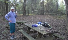
Cayce Picnic Area
Portage required. Parking lot off Naples Avenue with picnic area and scenic connector trail to...
Address:
203 Naples Avenue Cayce, SC 29033
203 Naples Avenue Cayce, SC 29033
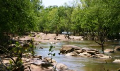
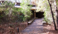
Congaree National Park: Bluff Trail
The highlight of the Congaree River Blue Trail, Congaree National Park is located 20 miles...
Address:
Congaree National Park, 100 National Park Rd, Hopkins, SC
Congaree National Park, 100 National Park Rd, Hopkins, SC
Congaree National Park: Weston Lake Loop Trail
The highlight of the Congaree River Blue Trail, Congaree National Park is located 20 miles...
Address:
Congaree National Park, 100 National Park Rd, Hopkins, SC
Congaree National Park, 100 National Park Rd, Hopkins, SC
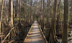
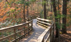
Congaree National Park: Boardwalk Loop
The highlight of the Congaree River Blue Trail, Congaree National Park is located 20 miles...
Address:
Congaree National Park, 100 National Park Rd, Hopkins, SC
Congaree National Park, 100 National Park Rd, Hopkins, SC
Congaree National Park: Kingsnake Trail
The highlight of the Congaree River Blue Trail, Congaree National Park is located 20 miles...
Address:
Congaree National Park, 100 National Park Rd, Hopkins, SC
Congaree National Park, 100 National Park Rd, Hopkins, SC
Congaree National Park: Oakridge Trail
The highlight of the Congaree River Blue Trail, Congaree National Park is located 20 miles...
Address:
Congaree National Park, 100 National Park Rd, Hopkins, SC
Congaree National Park, 100 National Park Rd, Hopkins, SC
Congaree National Park: River Trail
The highlight of the Congaree River Blue Trail, Congaree National Park is located 20 miles...
Address:
Congaree National Park, 100 National Park Rd, Hopkins, SC
Congaree National Park, 100 National Park Rd, Hopkins, SC
Three Rivers Greenway: Riverfront Park
The Three Rivers Greenway is a network of trails and parks centered around the rivers...
Address:
312 Laurel Street, Columbia, SC
312 Laurel Street, Columbia, SC
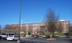
South Carolina State Museum
Housed in the historic 1893 Columbia Mill textile building, the South Carolina State Museum tells...
Address:
301 Gervais Street, Columbia, SC
301 Gervais Street, Columbia, SC
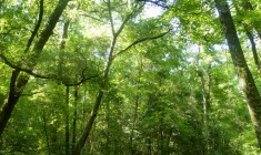
Congaree Creek Heritage Preserve
This 630-acre preserve borders the Congaree River and the City of Cayce, and protects stands...
Address:
Old State Road, Cayce, SC
Old State Road, Cayce, SC
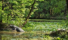
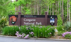
Congaree National Park
The highlight of the Congaree River Blue Trail, Congaree National Park is located 20 miles...
Address:
Congaree National Park, 100 National Park Rd, Hopkins, SC
Congaree National Park, 100 National Park Rd, Hopkins, SC
Congaree National Park: Devil’s Elbow
The highlight of the Congaree River Blue Trail, Congaree National Park is located 20 miles...
Address:
Congaree National Park, 100 National Park Rd, Hopkins, SC
Congaree National Park, 100 National Park Rd, Hopkins, SC
Congaree National Park: Stump Gut
The highlight of the Congaree River Blue Trail, Congaree National Park is located 20 miles...
Address:
Congaree National Park, 100 National Park Rd, Hopkins, SC
Congaree National Park, 100 National Park Rd, Hopkins, SC
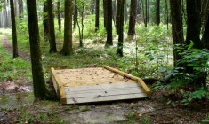
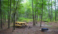
Congaree National Park: Bluff Primitive Campground
The highlight of the Congaree River Blue Trail, Congaree National Park is located 20 miles...
Address:
Congaree National Park, 100 National Park Rd, Hopkins, SC
Congaree National Park, 100 National Park Rd, Hopkins, SC
Congaree National Park: Longleaf Campground
The highlight of the Congaree River Blue Trail, Congaree National Park is located 20 miles...
Address:
100 National Park Rd, Hopkins, SC
100 National Park Rd, Hopkins, SC
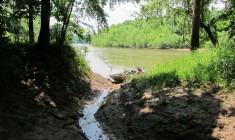
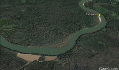
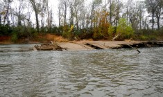
Sandbar #1
Note: At certain water levels, numerous sandbars are exposed all along the Congaree River. Sandbars...
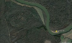
Sandbar #2
Note: At certain water levels, numerous sandbars are exposed all along the Congaree River. Sandbars...
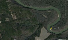
Sandbar #3
Note: At certain water levels, numerous sandbars are exposed all along the Congaree River. Sandbars...
Sandbar #5
Note: At certain water levels, numerous sandbars are exposed all along the Congaree River. Sandbars...
Congaree Bluffs Heritage Preserve
The Congaree Bluffs Heritage Preserve comprises 201 acres and contains steep bluffs bordering the Congaree...
Address:
Saint Matthews, SC
Saint Matthews, SC
Congaree National Park: Harry Hampton Visitor Center
The highlight of the Congaree River Blue Trail, Congaree National Park is located 20 miles...
Address:
Congaree National Park, 100 National Park Rd, Hopkins, SC
Congaree National Park, 100 National Park Rd, Hopkins, SC
Congaree National Park: Laurel Oak Primitive Backcountry Campground
The highlight of the Congaree River Blue Trail, Congaree National Park is located 20 miles...
Address:
Congaree National Park, 100 National Park Rd, Hopkins, SC
Congaree National Park, 100 National Park Rd, Hopkins, SC
Sandbar #1
Note: At certain water levels, numerous sandbars are exposed all along the Congaree River. Sandbars...
Sandbar #2
Note: At certain water levels, numerous sandbars are exposed all along the Congaree River. Sandbars...
Sandbar #4
Note: At certain water levels, numerous sandbars are exposed all along the Congaree River. Sandbars...
Sandbar #6
Note: At certain water levels, numerous sandbars are exposed all along the Congaree River. Sandbars...
Cherokee Path (Old State Road)
The Cherokee Path was once a direct route for traders and trappers Native Americans and...
Address:
Old State Road, Cayce, SC
Old State Road, Cayce, SC
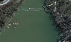
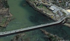
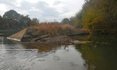
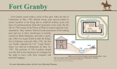
Granby Lock and Dam
Lowhead dam with lock. When water levels are low, the dam can be hazardous for...
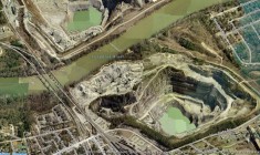
Granite Quarries
Two quarries located on opposite sides of the Congaree River are major sources of construction...
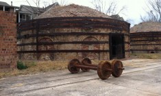
Guignard Brick Works
The Guignard Brick Works is an example of an early twentieth century industrial complex. It...
Address:
100 Granby Crossing, Cayce, SC
100 Granby Crossing, Cayce, SC
McCord’s Ferry (Bates Ferry)
Established in 1786, HugerÍs Ferry was located at the plantation of Isaac Huger, a general...
Myrick’s Ferry
Myrick’s Ferry, dating back to 1749, was located north of Mill Creek near Green Hill,...
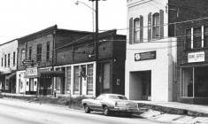
New Brookland Mill Village
This community emerged in 1894 as a home for operatives working at the Columbia Duck...
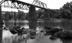
Norfolk Southern Railroad Bridge
The railroad segment from Branchville to Columbia is the second oldest railroad in South Carolina....
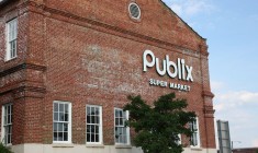
Publix Historic Building
This is an active grocery store that has partnered with the City of Columbia to...
Address:
501 Gervais Street, Columbia, SC
501 Gervais Street, Columbia, SC
Saxe Gotha Town
Saxe Gotha Township was established by Governor Robert Johnson in 1735. The Governor created the...
The Confluence
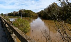
Shallow rocky area. A confluence is a place where two rivers or streams join together...
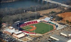
Carolina Baseball Stadium
This stadium is home to the University of South Carolina Gamecocks baseball team. It opened...
Address:
431 Williams St
Columbia, SC 29201
431 Williams St
Columbia, SC 29201
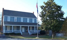
Cayce Historical Museum
This museum chronicles the history of the first European settlements in the midlands area of...
Address:
1800 12th Street, Cayce, SC
1800 12th Street, Cayce, SC
Columbia Chamber of Commerce
The Greater Columbia Chamber of Commerce is a private, non-profit, membership-driven organization that comprises more...
Address:
930 Richland Street, Columbia, SC
930 Richland Street, Columbia, SC
Howell’s Ferry
Howell’s Ferry was part of a road system constructed around 1756, by Thomas Howell, a...
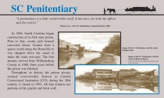
Old State Penitentiary
This site served as the South Carolina State Penitentiary from 1866 until 1994. Today, little...
Address:
Adjacent to Riverfront Park
Adjacent to Riverfront Park
S.S. Columbia Shipwreck
The S.S. Columbia was built in 1905 at a boatyard near the Senate Street side...
Address:
Accessible via west side of Three Rivers Greenway
Accessible via west side of Three Rivers Greenway
Columbia Museum of Art
South Carolina’s premier international art museum houses a world class collection of European and American...
Address:
1515 Main Street, Columbia, SC
1515 Main Street, Columbia, SC
EdVenture Children’s Museum
EdVenture is a museum aiming to inspire youth to enjoy learning. They have eight world-class...
Address:
211 Gervais Street, Columbia, SC
211 Gervais Street, Columbia, SC
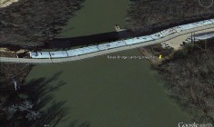
Bates Bridge (Hwy 601)
Under the John M. Bates Bridge where US 601 (McCords Ferry Road) crosses between Richland...
Address:
US-601 Eastover, SC
US-601 Eastover, SC
Congaree National Park: Emergency Take Out Point
The highlight of the Congaree River Blue Trail, Congaree National Park is located 20 miles...
Address:
Congaree National Park, 100 National Park Rd, Hopkins, SC
Congaree National Park, 100 National Park Rd, Hopkins, SC
Congaree National Park: Cedar Creek Canoe Access
Access to Cedar Creek Canoe Trail
...
Address:
Congaree National Park, 100 National Park Rd, Hopkins, SC
Congaree National Park, 100 National Park Rd, Hopkins, SC
Jordan (Rosewood) Landing
On river left roughly 0.5 miles below the Cayce Lock. This is primarily a boat...
Address:
645 Rosewood Drive, Columbia, SC
645 Rosewood Drive, Columbia, SC
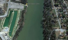
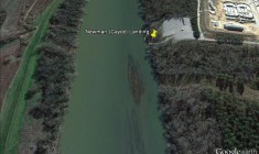
Newman (Cayce) Landing
At the end of Granby Landing Road, off Old State Road in Cayce, SC Boat...
Address:
Granby Landing Road, Cayce, SC
Granby Landing Road, Cayce, SC
Three Rivers Greenway: West Columbia Riverwalk
The Three Rivers Greenway is a network of trails and parks centered around the rivers...
Address:
121 Alexander Road, Columbia, SC
121 Alexander Road, Columbia, SC
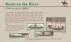
Barge #2
Historically, rivers served as the highways through the inland wilderness of South Carolina. Barges were...
Barge #3
Historically, rivers served as the highways through the inland wilderness of South Carolina. Barges were...
Barge #4
Historically, rivers served as the highways through the inland wilderness of South Carolina. Barges were...
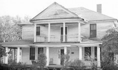
Cayce House (Granby Store)
The Cayce house is important to the community as one of the first residences constructed...
Address:
517 Holland Ave., Cayce, SC
517 Holland Ave., Cayce, SC
Columbia Dam and Fishway
More than 25 miles of the Broad River above Columbia, SC are now open to...
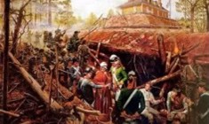
Fort Motte
During the American Revolution, the British seized and fortified the mansion of Rebecca Brewton Motte...
Congaree National Park: Bannister Bridge Canoe Access
On Old Bluff Road at the edge of the park; beginning of Cedar Creek Canoe...
Address:
100 National Park Rd, Hopkins, SC
100 National Park Rd, Hopkins, SC
Granby Park
Part of the Three Rivers Greenway network of trails and parks centered around the rivers...
Address:
100 Catawba Street, Columbia, SC
100 Catawba Street, Columbia, SC
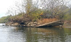
Barge #1
Historically, rivers served as the highways through the inland wilderness of South Carolina. Barges were...
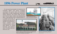
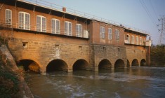
Columbia Canal and Water Works
Now part of the 167-acre Riverfront Park, the Columbia Canal was constructed in 1824 by...
Address:
312 Laurel Street, Columbia, SC
312 Laurel Street, Columbia, SC
Congaree National Park: Huger’s Ferry
The highlight of the Congaree River Blue Trail, Congaree National Park is located 20 miles...
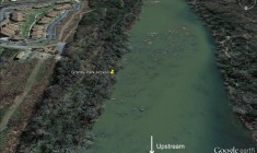
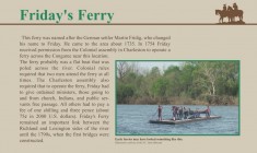
Friday’s Ferry
FridayÍs Ferry connected the village to a landing on the Richland side of the river....
Gervais Street Bridge
At least three unsuccessful attempts were made in the 1790s to bridge the Congaree River....
Address:
Gervais Street, Columbia, SC
Gervais Street, Columbia, SC
http://www.bluetrailsguide.org/wp-content/uploads/sites/6/2014/06/ThreeRiversGreenway_Google.kmlhttp://www.bluetrailsguide.org/wp-content/uploads/sites/6/2014/06/CongareeCreekHP_Google.kmlhttp://www.bluetrailsguide.org/wp-content/uploads/sites/6/2014/06/CongareeBluffsTrails_Google.kmlhttp://www.bluetrailsguide.org/wp-content/uploads/sites/6/2014/06/CedarCreek_Google.kmlhttp://www.bluetrailsguide.org/wp-content/uploads/sites/6/2014/06/CNP_Buildings_Google.kmlhttp://www.bluetrailsguide.org/wp-content/uploads/sites/6/2014/06/CNP_Trails_Google.kml